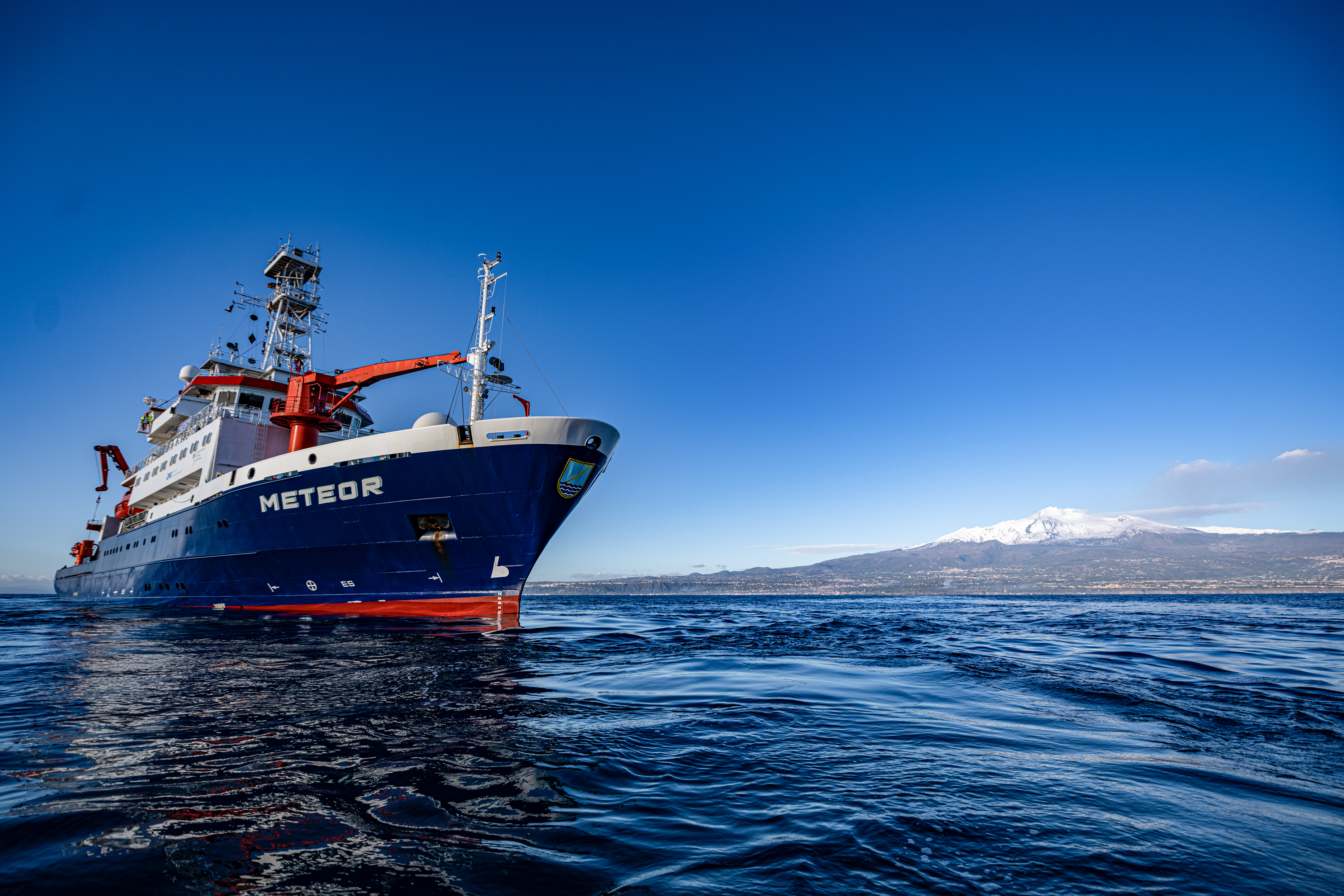
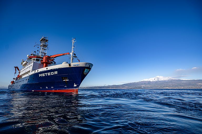
The research vessel METEOR set off on a two-week expedition to investigate the flank instability of Mount Etna in the Mediterranean. Photo: Felix Gross, CAU
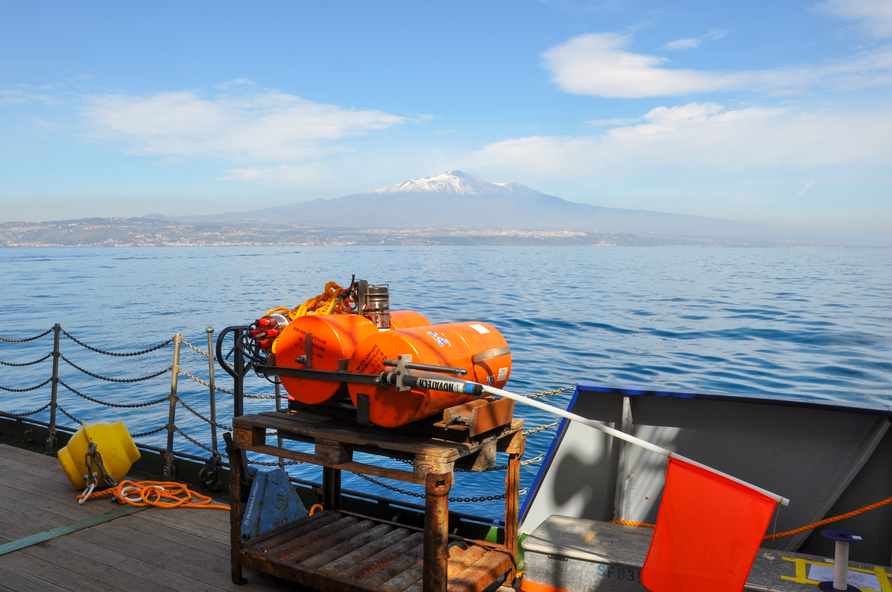
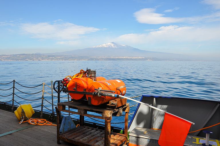
Mount Etna (in the background) is Europe's highest volcano, reaching over 3000 metres. Its south-eastern flank protrudes far into the Mediterranean and can only be monitored using special submarine measuring technology. Photo: Anne Krabbenhöft
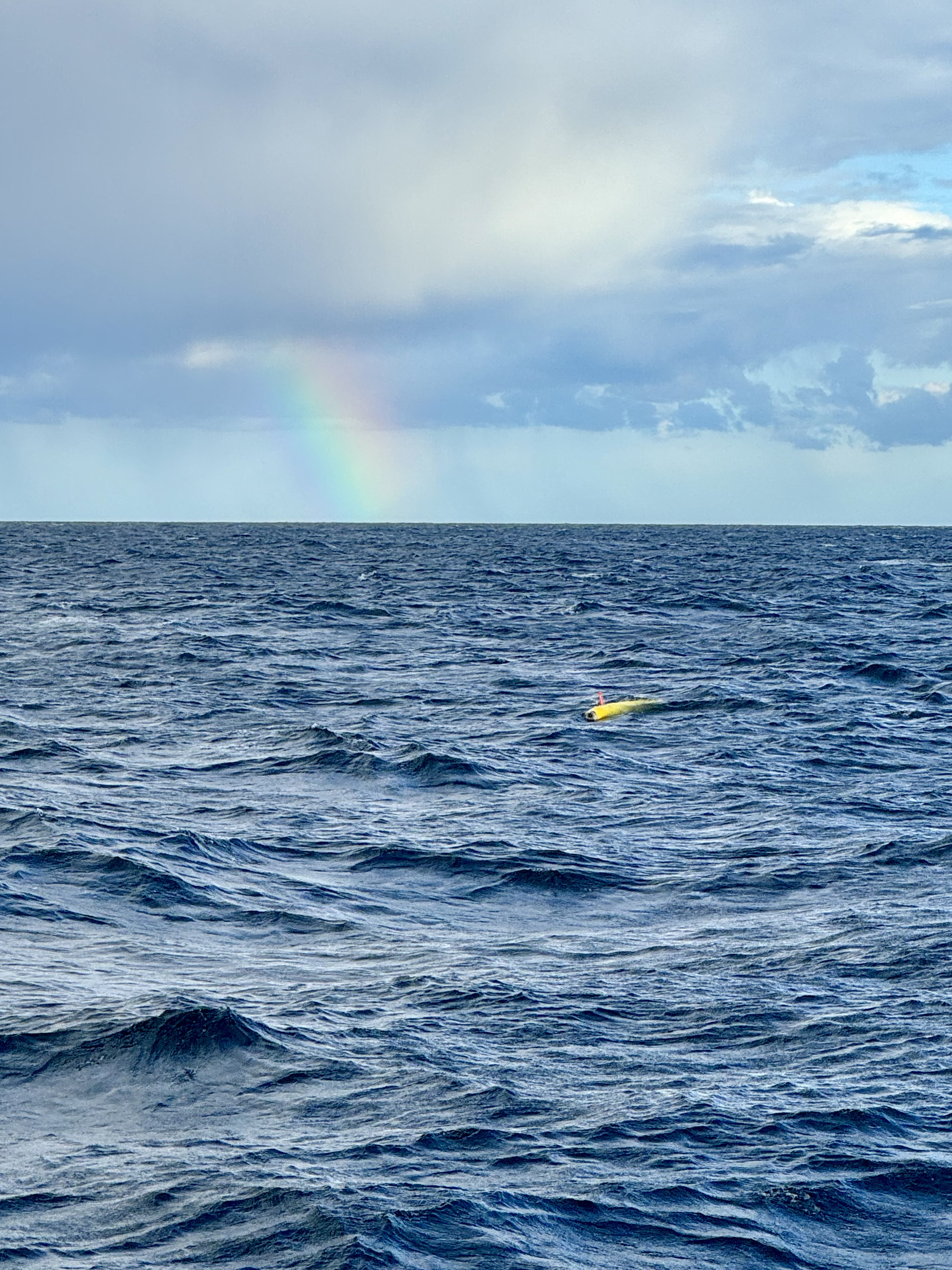
Autonomous underwater vehicles (AUVs) are used to map the seabed over a wide area. Photo: Katja Matthes
Chief scientist Professor Dr Morelia Urlaub focuses her research on natural hazards, including landslides and tsunamis. Photo: Thore Sager, GEOMAR
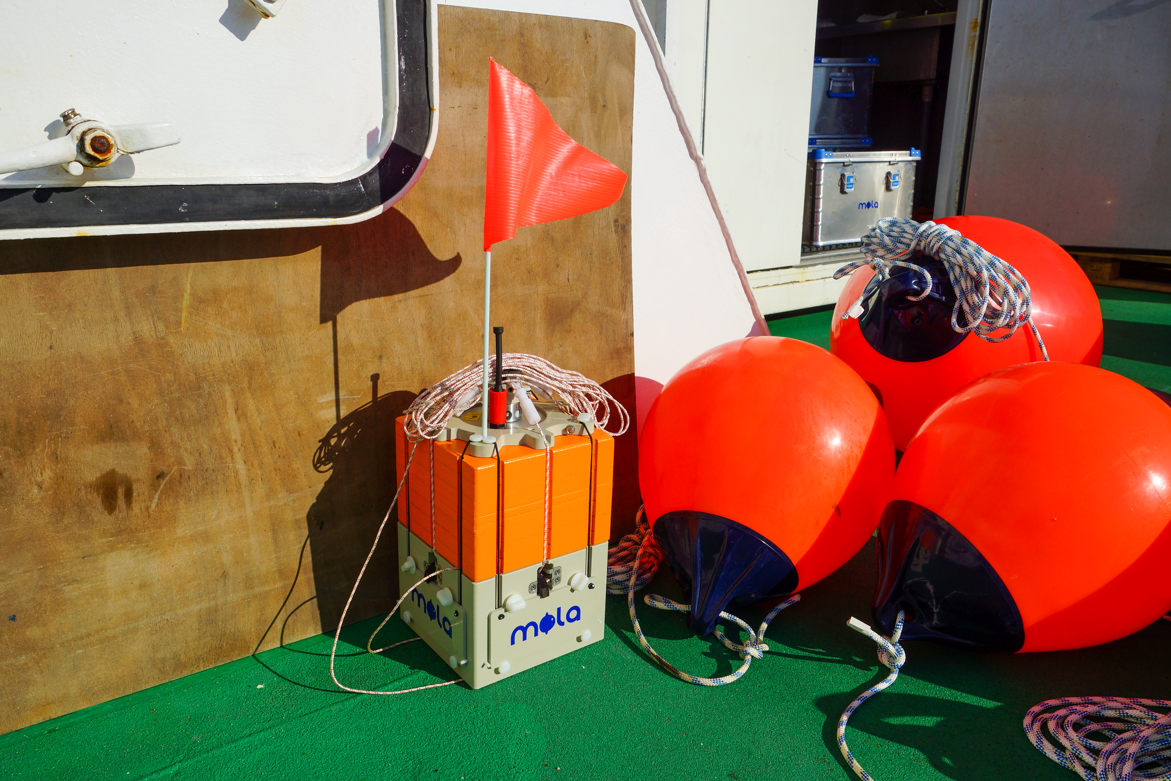
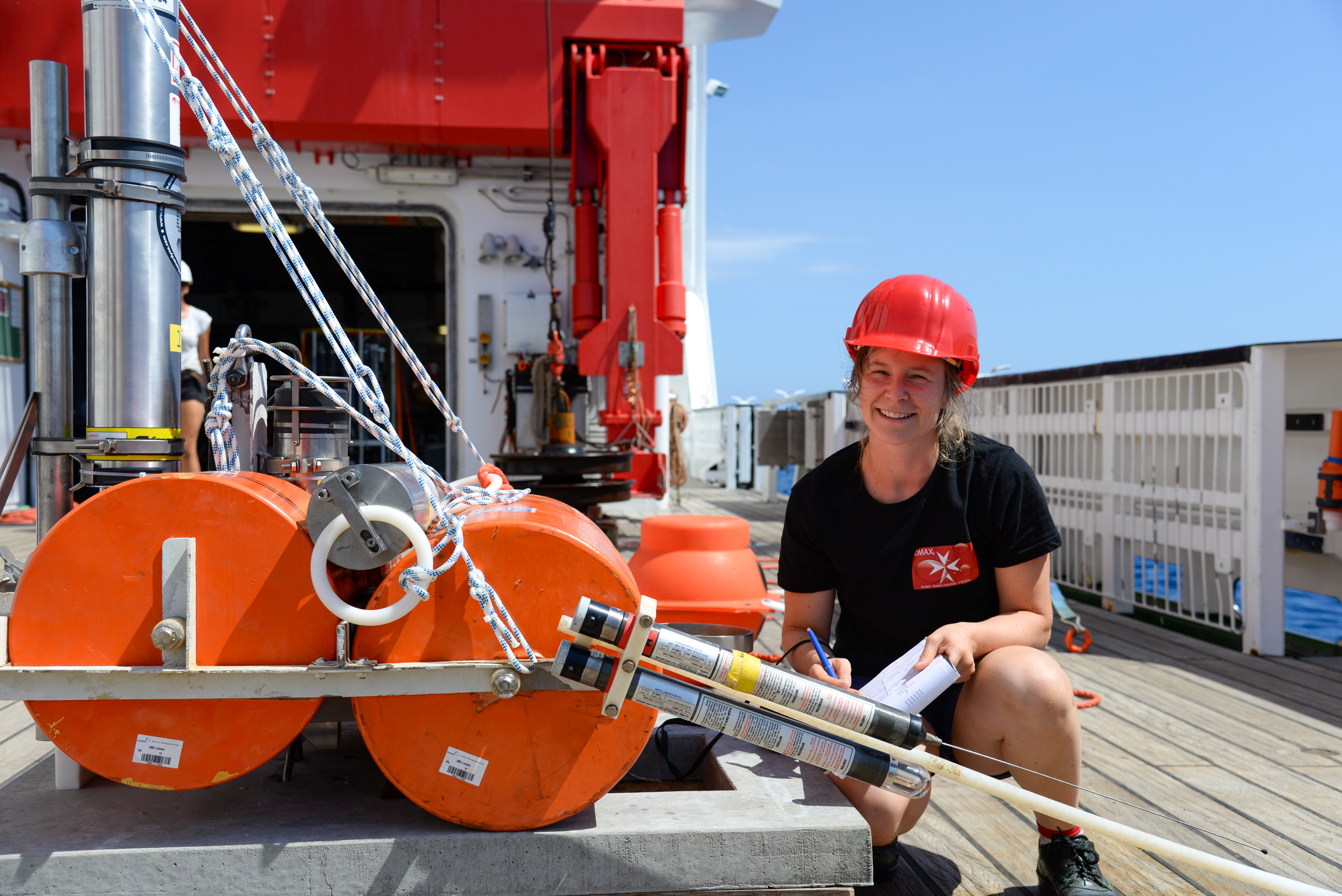
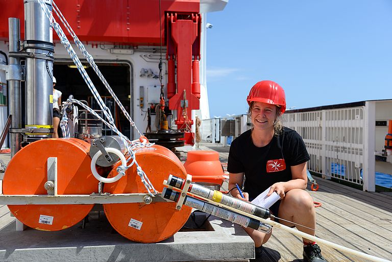
During the expedition, practical testing of small landers called MOLAs will take place. These landers could provide a cost-effective and easy-to-handle alternative to conventional large launch frames. Photo: Stefan Kontradowitz
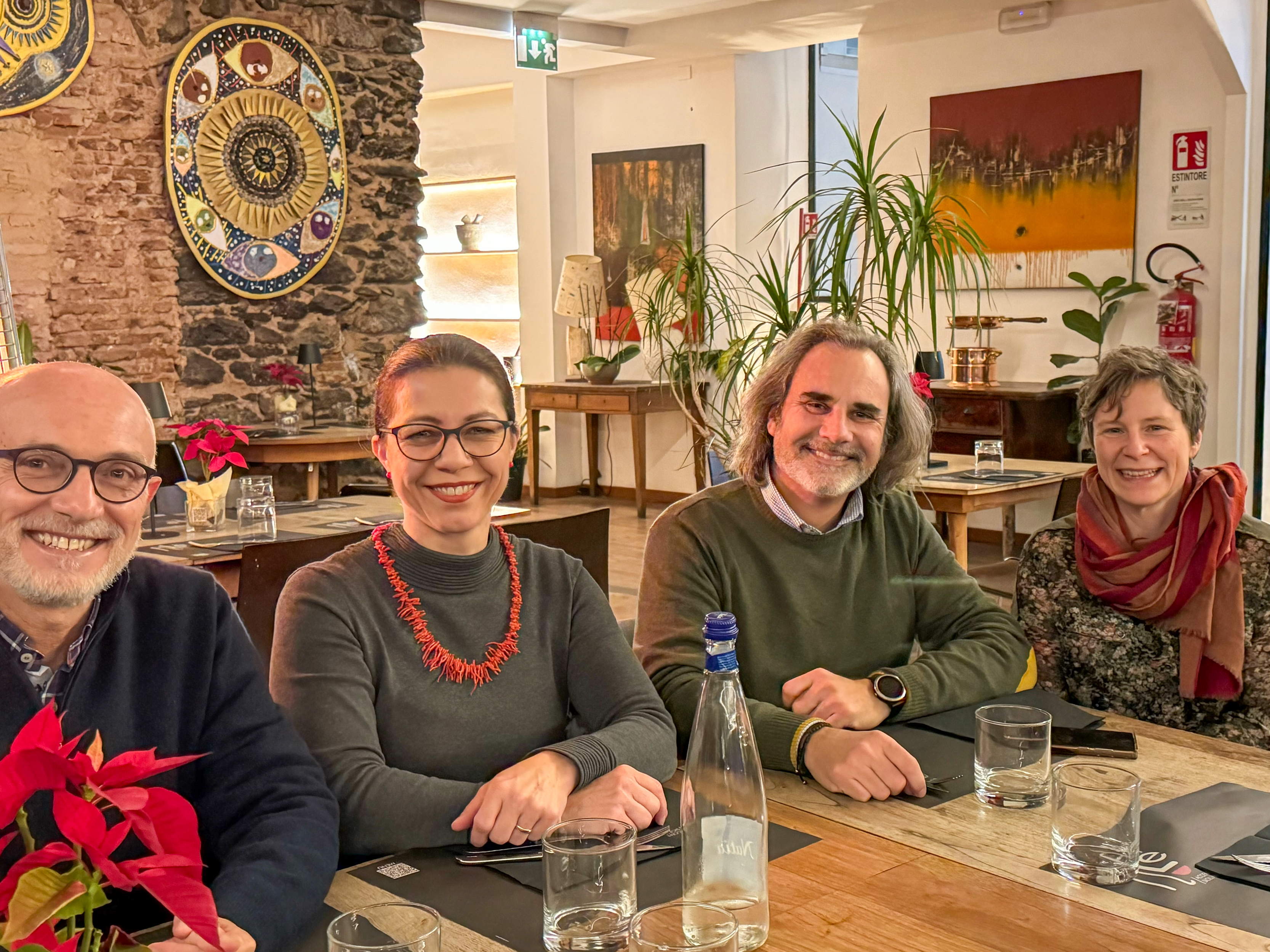
Dr Stefano Branca, Director of the Italian Volcanological Institute (INGV) in Sicily (left) and GEOMAR Director Professor Dr Katja Matthes met in Catania to discuss further cooperation between their research institutions. Dr Alessandro Bonforte, scientist at the INGV, is joining the M198 expedition led by Professor Dr Morelia Urlaub (right). Photo: Branca
Diving down to the base of the Etna volcano
METEOR Expedition M198 explores flank instability
Mount Etna is the highest volcano in Europe. At more than 3,000 metres, its summit towers over the port city of Catania on the east coast of Sicily. But much of the volcano is underwater - its south-eastern flank stretches far into the Mediterranean. A flank that is constantly moving, as previous studies have shown. “The whole volcanic edifice is very high and heavy,” says Professor Dr Morelia Urlaub, marine geoscientist at the GEOMAR Helmholtz Centre for Ocean Research in Kiel. “As a result, the volcano is constantly trying to expand in all directions. It can do this most easily towards the sea”. Slow flank motion is not dangerous in itself and can be observed in many volcanoes around the world. However, there are examples where a slow flank motion can suddenly lead to a rapid, catastrophic collapse and a devastating tsunami. Determining when and under what conditions such dangerous events can occur is a focus of research at GEOMAR.
In order to gain a better understanding of the structure of the flank, a German-French-Italian team of experts sets off today on an expedition off the coast of Sicily. The central question: Does the flank move as a whole or in separate blocks? Comprehensive mapping of the seafloor using Autonomous Underwater Vehicles (AUVs) and selective long-term measurements will fill this knowledge gap. Together with land-based observations of the volcano's movements and the sliding of the eastern flank, a cross-coastal observatory can be developed.
While satellite-based GPS and radar measurements, among others, help to monitor the volcano on land, this does not work underwater. However, the relatively new field of seafloor geodesy has made it possible to monitor the area using sound waves: in 2016, an acoustic survey network consisting of five autonomous transponders was deployed on the seafloor for the first time and has been collecting data ever since. “The fact that several of these devices communicate with each other means that the distance between the devices can be determined to the nearest centimetre using the propagation time of the sound waves. If the propagation time changes, the relative movements can be calculated,” explains Dr Morelia Urlaub. As the devices are installed on the part of the slope that is sliding on one side and on the part of the slope that is considered stable on the other side, the relative sliding rate can be determined. The devices need to be checked and maintained every few years. One of the tasks of Expedition M198 will be to retrieve the geodetic stations and reinstall the monitoring network for a further three years.
At the same time, the seafloor monitoring system will be extended. Dr Morelia Urlaub: “The existing infrastructure will be supplemented by two piezometers to measure pore pressure and temperature in the top five metres of the sediment”. This method has not yet been used on volcanic flanks, but the parameters measured could provide information on flank movements. Dr Jens Karstens, GEOMAR geophysicist, explains: “By moving a section of the flank, we expect changes in pore pressure and temperature, which we want to combine with the high-precision geodetic measurements. At the same time, we are testing whether it is possible to measure changes in fluid flow in advance of a flank movement. Such changes in fluid flow have already been observed in the context of earthquakes - whether this is also the case for flank movements is still unexplored”. It would therefore be a great gain in knowledge if a signal in the pore pressure could be measured.
During the cruise, Dr Karstens will also test another innovation developed at the GEOMAR Technology Centre: MOLAs (Modular Ocean Lander Architecture) - mobile landers, no bigger than a camping cooler. They can be equipped with different scientific instruments depending on the application and could offer a cost-effective and easy-to-handle alternative to the conventional large launch frames.
Tried and tested technology will be used to learn more about the volcano's history: Rock samples are taken with a chain bag excavator. Dr Morelia Urlaub: “Etna was formed and grew where there is now water. The different rocks can tell us more about its formation and therefore about the structure of the flank”.
The Italian volcanological institute (Istituto Nazionale di Geofisica e Vulcanologia, INGV), with which GEOMAR has been working closely since 2015, is also very interested in the research. GEOMAR Director Professor Dr Katja Matthes, who is accompanying the Mediterranean expedition, took the opportunity to meet her Italian colleague, Director Dr Stefano Branca, in Catania. She emphasised: “The long-standing partnership between GEOMAR and INGV is invaluable. Through our efforts on land and underwater, together we are helping to unravel the mysteries of Etna and promote a broader global understanding of volcanic activity. Of particular importance is the knowledge gained from sea-based research, such as expeditions like this one. Every advance in our knowledge is another step towards tsunami early warning systems, which will contribute significantly to minimising risks and protecting coastal populations”.
Research on marine natural hazards is a central focus at GEOMAR. In this area, the Institute is coordinating the ground-breaking MULTI-MAREX project as part of the third research mission “mareXtreme” of the German Marine Research Alliance (DAM).
Expedition at a glance:
METEOR Expedition M198
Chief scientist: Prof. Dr Morelia Urlaub
09. - 22. February 2024
Start: Catania (Italy)
End: Catania (Italy)
Project funding:
The expedition is funded by the German Federal Ministry of Education and Research (BMBF) and the Helmholtz Association (Helmholtz Young Investigators Group "Do volcanoes collapse retrogressively?"; "MOLA - Modular Ocean Lander Architecture" as part of the Transfer Campaign of the Initiative and Networking Fund of the Helmholtz Association).
The research vessel METEOR set off on a two-week expedition to investigate the flank instability of Mount Etna in the Mediterranean. Photo: Felix Gross, CAU
Mount Etna (in the background) is Europe's highest volcano, reaching over 3000 metres. Its south-eastern flank protrudes far into the Mediterranean and can only be monitored using special submarine measuring technology. Photo: Anne Krabbenhöft
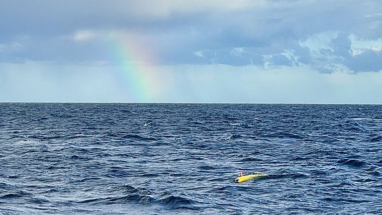
Autonomous underwater vehicles (AUVs) are used to map the seabed over a wide area. Photo: Katja Matthes
Chief scientist Professor Dr Morelia Urlaub focuses her research on natural hazards, including landslides and tsunamis. Photo: Thore Sager, GEOMAR

During the expedition, practical testing of small landers called MOLAs will take place. These landers could provide a cost-effective and easy-to-handle alternative to conventional large launch frames. Photo: Stefan Kontradowitz
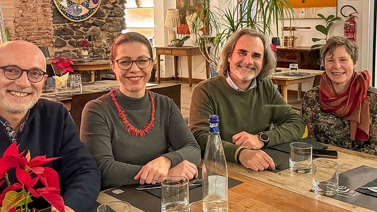
Dr Stefano Branca, Director of the Italian Volcanological Institute (INGV) in Sicily (left) and GEOMAR Director Professor Dr Katja Matthes met in Catania to discuss further cooperation between their research institutions. Dr Alessandro Bonforte, scientist at the INGV, is joining the M198 expedition led by Professor Dr Morelia Urlaub (right). Photo: Branca