Data Collection for Tsunami Early Warning Systems
Expedition MSM132 Investigates Volcanic Hazards in the Aegean
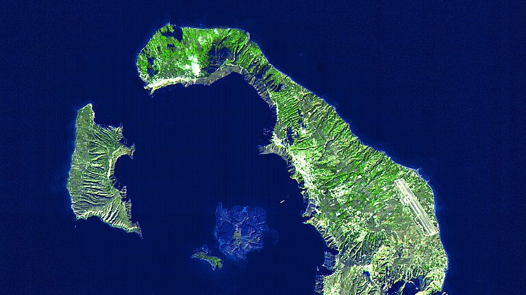
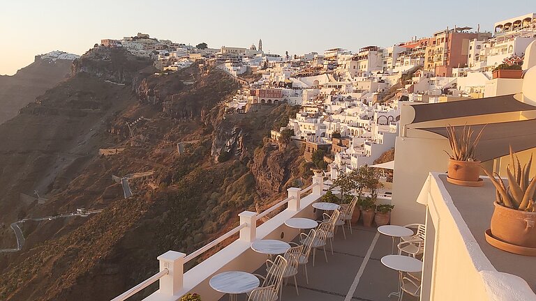
The Santorini archipelago in the South Aegean Sea, famous for its whitewashed houses with blue domes, is not only a popular tourist destination but also a key area for volcanic research. The ring-shaped islands mark the edge of a sea-filled caldera created by the massive Minoan eruption approximately 3,600 years ago. Kolumbo volcano, located 7Km, NE of Santorini, is part of a chain of more than 26 submerged volcanoes that form the Kolumbo volcanic field.
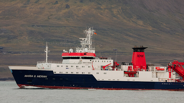
An international team of researchers departed from Italy today aboard the German research vessel MARIA S. MERIAN to investigate the hazards posed by this volcanic field. A particular focus is on the submarine active volcano of Kolumbo who has been erupted in 1650 after one year of intense seismicity. The scientists aim to examine how extreme geohazards interact—for instance, how a volcanic eruption could trigger a tsunami. Their findings are expected to improve the long-term safety of coastal regions.
“With expedition MSM132, we are studying one of the most active and hazardous volcanic systems in Europe. The region has a history of numerous eruptions, some of them highly explosive in the past,” explains Chief Scientist Professor Dr Christian Berndt, a marine geophysicist at GEOMAR Helmholtz Centre for Ocean Research Kiel. “Our goal is to better understand what triggers earthquakes, landslides, and tsunamis. At the same time, we are testing new monitoring systems to help protect the people of the Aegean from these dangers.”
Four central questions guide the researchers:
- Can earthquakes trigger landslides?
The researchers are using high-resolution bathymetric maps and seismic measurements to assess whether tectonic movements could destabilise slopes, causing them to collapse.
- How does volcanic activity affect the stability of the volcano?
The team is mapping the intense hydrothermal activity within the Kolumbo crater, where hot water and gases alter the rock. The aim is to identify weak points in the volcanic structure that could lead to potential hazards.
- What is the relationship between earthquakes and volcanic eruptions?
Two- and three-dimensional seismic measurements will investigate how fractures in the rock and volcanic processes influence each other—a crucial step towards understanding potential triggers of extreme events.
- How can volcanic activity be detected early?
The researchers are testing an innovative early warning system that uses state-of-the-art seafloor sensors to collect real-time data on earthquakes, ground movements, and volcanic gases. This technology is designed to enable reliable monitoring of submarine volcanoes.
The MSM132 expedition is the first of three planned research cruises as part of the MULTI-MAREX project, which investigates marine extreme events and natural hazards in the Mediterranean region. The project is one of four projects in the third research mission of the German research alliance mareXtreme, funded by the Federal Ministry of Education and Research (BMBF) and the five northern German states.
Expedition MSM132: At a Glance
Name: MARIA S. MERIAN Expedition MSM132
Chief Scientist: Prof. Dr Christian Berndt
Dates: 03 December 2024 – 02 January 2025
Departure: Catania, Italy
Arrival: Heraklion, Greece
Area: Mediterranean Sea, Aegean Sea
About MULTI-MAREX:
As part of the DAM (Deutsche Allianz Meeresforschung, German Marine Research Alliance) research mission mareXtreme (“Pathways to Improved Risk Management for Marine Extreme Events and Natural Hazards”), GEOMAR coordinates the collaborative project MULTI-MAREX. Under the leadership of Professor Dr Heidrun Kopp, 50 researchers from various disciplines are working to reduce the risks of geomarine extreme events such as earthquakes, volcanic eruptions, and tsunamis.
MULTI-MAREX combines innovative technologies, such as AI-based monitoring systems and underwater communication tools, with societal collaboration at the local level. The goal is to improve risk prediction, enhance early warning systems, and develop robust protection measures together with authorities and local communities.
The DAM research mission mareXtreme is funded by the Federal Ministry of Education and Research (BMBF) and the five northern German states.

Expedition MSM132: An international team of scientists set sail today on the research vessel MARIA S. MERIAN to study the Kolumbo volcanic system near Santorini. Photo: Adobe Stock

Santorini: The ring-shaped islands mark the edge of a sea-flooded caldera created by the great Minoan eruption some 3,600 years ago. Photo: NASA

The Santorini archipelago in the Greek Aegean is not only a popular holiday destination, but also a key area for volcanic research. Photo: Paraskevi Nomikou

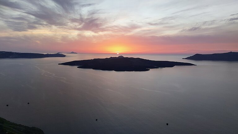
The Santorini archipelago is part of a chain of more than 20 volcanoes, most of which lie below sea level. Photo: Paraskevi Nomikou

During the expedition, the international team will investigate how extreme events can interact. The aim is to gain insights that can improve the safety of coastal regions in the long term. Photo: Paraskevi Nomikou


