Artificial intelligence applied to mapping of the seafloor and marine spatial planning – KIMERA

So far and despite all efforts only about 25 % of the ocean floor are mapped using hydroacoustic methods. This means that we know very little about the nature of the remaining 75 %. This knowledge is based on satellite measurements of the Earth's gravity and the derivation of seafloor morphology from that data. However, the comparison of satellite derived data to hydroacoustic data reveals that quite often there are major mismatches in the resulting digitial elevation models in all three dimensions. Also the knowledge about seafloor morphology is only a first steps towards an understanding of its nature. Predictions on the probability for mineral potentials or the presence of habitats linked to specific oceanographic parameters can be derived only from here. And this knowledge is key for combining the need for conservation and restoration of the oceans on the one and allowing for a sustainable use on the other hand.


This is were the 'KIMERA' projects starts. KIMERA is the German acronym for 'Artificial intelligence applied to mapping of the seafloor and marine spatial planning'. Within the 36 months-long duration of the project, a method for the predictive mapping (RPM) of the nature of the seafloor using machine learning and artificial intelligence will be developed in collaboration with a regional private entity. This information will then guide the prediction of certain habitats or mineral potentials. This is a first important step towards marine spatial planning based on scientific evidence, which needs future ground-truthing.


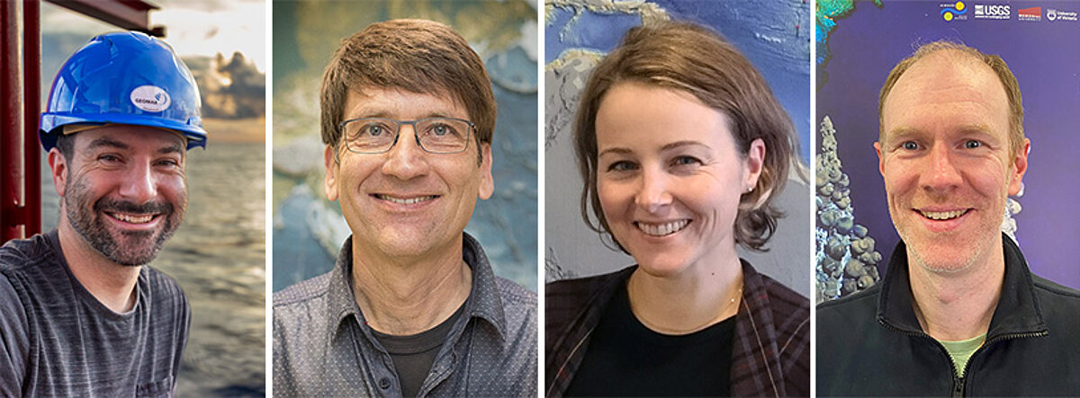
Team "KIMERA"

Geological classification of volcanic structures

The programming language Python and the open source program library PyTorch were chosen as the basis for the programmatic implementation of the artificial intelligence. The programmed code is stored locally and on an internal GEOMAR GitLab server for version management and project planning. The following steps were carried out as part of the creation of an initial AI prototype:

  • Determination of the required data transformations to convert GIS data into input data for an artificial intelligence.
  • An initial strategy for dealing with missing data points was outlined and implemented programmatically in various approaches - replacement by a fixed value, replacement by a statistical mean.
  • Several approaches for standardizing or normalizing the initial data were implemented.
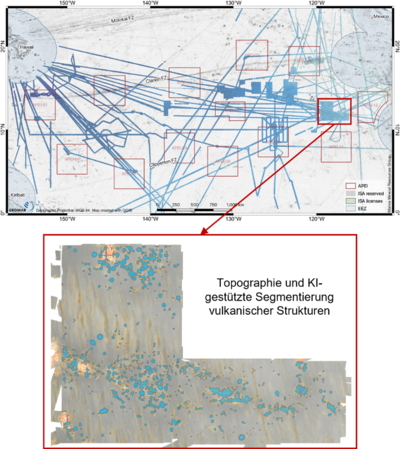
  • Based on existing AI algorithms for the segmentation of image content, a first prototype for the segmentation and geological classification of volcanic structures in the Clarion-Clipperton Zone was created (see Figure 1).

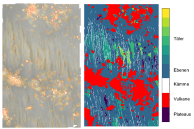
  • An initial strategy for easily annotated (a sufficiently large data set of manual annotations by experts is expected) and poorly annotated (a sufficiently large data set is not expected) geological features was developed. This includes various deep learning models as well as machine learning and classical, parameter-based approaches for both classes. Preliminary scientific work in this regard is recorded in a literature review. In this context, an initial approach for the identification of deep-sea hills and plains, a poorly annotatable feature, was also developed (see Figure 2).

Our partner

The company north.io GmbH, based in Kiel, specializes in the organization and management of geodata on land and at sea. North.io provides the KIMERA project with cloud computing, web technologies and geoinformatics and is working on the development of a web-based annotation tool on our behalf.


This project is funded by:


To top