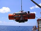
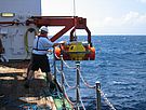
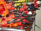
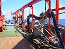
The deparment of Marine Geodynamics uses a broad range of infrastructure to
investigate the geological process below the seafloor. Apart from the instruments
that are permanently installed on German research vessels, i.e. sub-bottom
profilers and multi-beam echosounders, we operate seismic, electromagnetic,
and geodetic instruments. Furthermore, there are side scan sonars and a heat
flow probe. These instruments are mobilized for the expeditions depending on
the scientific needs.
Perhaps most important is the seismic infrastructure as it allows to image the
subsurface with very high resolution. We are using various seismic sources
depending on how deep we have to look into the seafloor. The large airgun array
can image down to 35 km and up to 200 km horizontally, while smaller arrays
only penetrate the uppermost few hundred meters at a resolution of 5 meters.
These signals get recorded either at the surface with 2D and 3D seismic
hydrophone chains called streamers or at the seafloor. With almost one hundred
instruments GEOMAR owns one of the largest ocean bottom seismometer pools
worldwide. These instruments can not only record man-made seismic
signals but also earthquake tremors.
To learn about the physical properties of the rocks below the seafloor and the
distribution of hydrocarbons and mineral resources we use different
electromagnetic instruments. These measure either the variations of the
Earth' magnetic field as it is modulated by solar wind or signals that we
generate with an electromagnetic antenna close to the seafloor. Like the
ocean bottom seismometers most of the electromagnetic instrumentation
was developed in-house.
Marine geodetic instruments are another important part of our geophysical
infrastructure. These instruments comprise acoustic ranging devices
that measure the distance between each other and tilt meters that measure
minute amounts of tilt at the seafloor. While these techniques are not as
accurate as geodetic measurements on land they provide unique insights into
the dynamic changes of the seafloor such as slope movements or stress
build up prior to earthquakes.
The following instruments and components are deployed for investigation:


